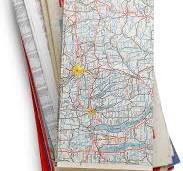
In the old days (like 25 years ago), we used to have maps. If we wanted to get someplace, we had never been before, we used road maps. We had them stuffed in glove compartments and in the sides of the doors. We bought new ones every couple of years in case a new highway came into play.
The big problem with the old maps was how to fold them. They were like paper Rubik’s cubes. You had to fold them exactly right to restore them to their original shape, which I never once did correctly. I ended up just wadding them up and stuffing them in the side pockets. But in the olden days of road maps, you had your own GPS person, live and in the car with you.
“Where we do we turn off?” you would ask your GPS person (your wife).
“I don’t know. I don’t read maps well,” the GPS person would say.
“It might help if you didn’t hold the map upside down,” you might suggest and then get swatted on the side of your head with the map by your GPS person.
But with road maps, you always had a back-up. The guy at the filling station.
“I think I’m lost. How do I get to Churchville?”
“You missed your turn off, buddy,” he would say. “It was 30 miles back up the road just past the First Baptist cemetery.
Today, we don’t have maps. We have a little man that lives in our phones and he knows his stuff. He knows every road in the entire world by name, and he knows exactly how long they are.
“In 1,322 ½ feet turn right at the exit,” he advises.
That’s fine, except when you’re doing 65 miles per hour and there is a tractor trailer on your ass, it’s hard to judge exactly when the 1,322 ½ feet end and there are two possible exits.
“Take this one, dammit,” says the little man in the phone. “Now, follow the road and next time pay more attention!”
I miss the old road maps. At least they never talked back to you if you took a wrong turn.